
ARCADIA ORCHARD
Arcadia Orchard Concrete Headstones: Monuments to a Failed Business Scheme
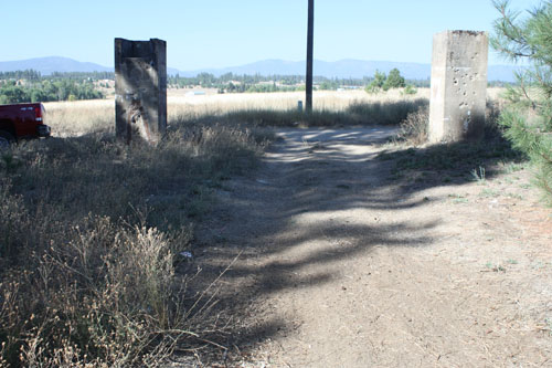
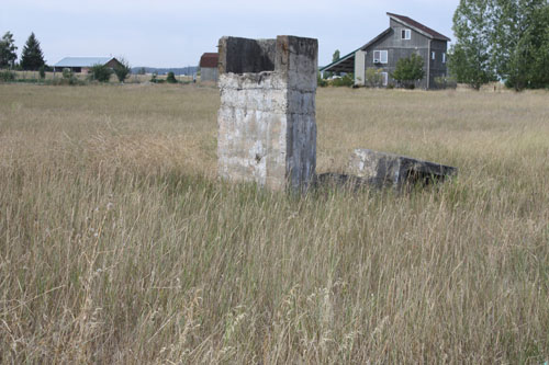
On the north side of Montgomery Road between Deer Park and Clayton, Washington, stand four large concrete structures. Only the two, at Grove and Montgomery Road stand opposite one another with round entrances facing east and west that lead down into a tunnel under the road. They are part of what remains of the irrigation system for Arcadia Orchards.
The Arcadia Orchard was an early 1900's development that nearly surrounded Deer Park. In 2009 all that remains of this failed business venture are scattered concrete road underpasses, concrete flume supports, a concrete dam on Dragoon Creek and various ditches that once carried irrigation water.In popular myth the orchard failed because the irrigation water taken from Loon Lake and Deer Lake ran out, or atleast lowered the lake levels unacceptably. To my knowledge no comprehensive study of the Arcadia Orchards business venture has been published. However, a very interesting and well researched unpublished manuscript written by John Fahey comes very close (Fahey, 1993). In it he documents the inception, growth and failure of the venture. Mr. Fahey was a history professor at Eastern Washington University and had written extensively on the history of eastern Washington. In this manuscript he attributes the orchard's failure to poor management, poor promotional business practices, and several national business recessions. In addition a short growing season (with killing frosts during the growing season!), production of apple varieties other than the Red Delicious that did not sell well and competition from other orchard areas in Washington helped hasten the end of the Arcadia Orchard Company.
The Arcadia Orchards began in 1906 and officially ended in 1924. In the years between 1910 and 1916 the largest amount of land was put into production and an irrigation system built. The system began with a canal and valve at the south end of Loon Lake. The valve fed water into ditches cut across the north side of the gently south sloping expanse of land between the hills north of Garden Spot to the Dragoon Creek drainage on the south.
Originally the main irrigation ditches were dug into the dirt but early promotional success and incoming money caused the inefficient ditches to be replaced by iron bound wooden stave pipes and underground concrete piping. The circular openings in the Montgomery Road underpasses are the remaining evidence of these wooden pipes.
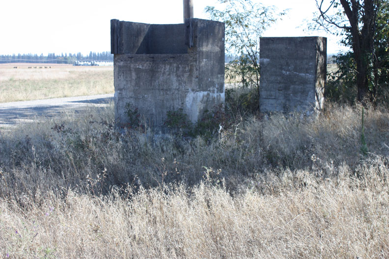
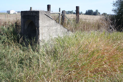
South of Deer Park, along Antler Road, Weber Road and Staley Road square concrete underpass and flume supports stand. At their top one or more sides have a lower wall containing rusting bolts that once held the wooden flumes that carried the water to the apple trees.
Flyers distributed as promotional material indicate that over 7000 acres of fruit trees had been planted by 1916 and were being irrigated by over 24 miles of main distribution ditches, tunnels and flumes and over 50,000 feet of buried concrete pipe.
Recently during the construction of the east Crawford Street extension a large circular irrigation pipe was uncovered at the entrance to the Deer Park Country Club. Early road builders filled it in and built the Deer Park-Milan road over it. The present construction removed the concrete pipe and filled in the hole properly.
Concrete pipe was cast by the Deer Park Artificial Stone Company. The plant was located 310' south of the Deer Park apple packing house (Sanford map) just about where the present Hagen Hardware building is now.
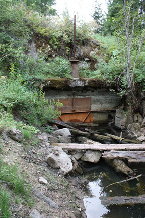
Dragoon Creek was dammed in 1913 just upstream of its confluence with Spring Creek. Faint etching in the concrete at the top of the dam reads "NOV 1913".
One early Deer Park Sanborn Map Company Fire Insurance map dated 1915 (with revisions in 1932 and 1940) shows an irrigation flume running southeast along Railroad Avenue in Deer Park. Another map in the same folio shows another flume trending straight south from the old Husky bulk oil terminal (and east of the Great Northern Railroad depot) at Main Avenue and A Street. None of this flume construction can be seen today.
The lake backed up by the dam became the mill pond for the Deer Park Lumber Company. With all the mill buildings gone a walk across the site today leaves one with the impression that much dredging and bank construction had to have been done southeast of the dam. This is in the area where logs were unloaded from trucks and train cars into the mill pond. Without this embankment the dam as it was built would not have held much because the water could have easily overflowed the low drainage divide into Spring Creek.
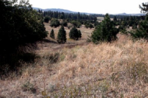
Today only a few concrete structures mark the Arcadia Orchards irrigation works and business venture. Nature has preserved several areas of the orchard with trees still producing apples nearly 100 years after having been planted.
In several areas the apple trees stand along in neat rows, in other areas ponderosa pine trees tower over the rows of apple trees still trying to survive.
The apple trees and concrete irrigation structures are all that remain of a business that failed and financially hurt investors all across the United States and parts of Europe.
REFERENCES CITED
Anon., 1916, Arcadia Orchards Company, Irrigated Orchards: Deer Park (?), Printer (?), no pagination. (a promotional flyer)
Anon., 1940, Fire insurance map of Deer Park: San Francisco, CA, Sanborn Map Company. 5 p. (Original base maps drafted Sept. 1915)
Fahey, John, 1993, Selling the watered west: Arcadia Orchards: Spokane, Unpublished manuscript, 57 p., 13 p. references. (This has been published in the Pacific Historical Review No. 62, p 453-474)
The Arcadia Orchard was an early 1900's development that nearly surrounded Deer Park. In 2009 all that remains of this failed business venture are scattered concrete road underpasses, concrete flume supports, a concrete dam on Dragoon Creek and various ditches that once carried irrigation water.In popular myth the orchard failed because the irrigation water taken from Loon Lake and Deer Lake ran out, or atleast lowered the lake levels unacceptably. To my knowledge no comprehensive study of the Arcadia Orchards business venture has been published. However, a very interesting and well researched unpublished manuscript written by John Fahey comes very close (Fahey, 1993). In it he documents the inception, growth and failure of the venture. Mr. Fahey was a history professor at Eastern Washington University and had written extensively on the history of eastern Washington. In this manuscript he attributes the orchard's failure to poor management, poor promotional business practices, and several national business recessions. In addition a short growing season (with killing frosts during the growing season!), production of apple varieties other than the Red Delicious that did not sell well and competition from other orchard areas in Washington helped hasten the end of the Arcadia Orchard Company.
The Arcadia Orchards began in 1906 and officially ended in 1924. In the years between 1910 and 1916 the largest amount of land was put into production and an irrigation system built. The system began with a canal and valve at the south end of Loon Lake. The valve fed water into ditches cut across the north side of the gently south sloping expanse of land between the hills north of Garden Spot to the Dragoon Creek drainage on the south.
Originally the main irrigation ditches were dug into the dirt but early promotional success and incoming money caused the inefficient ditches to be replaced by iron bound wooden stave pipes and underground concrete piping. The circular openings in the Montgomery Road underpasses are the remaining evidence of these wooden pipes.
South of Deer Park, along Antler Road, Weber Road and Staley Road square concrete underpass and flume supports stand. At their top one or more sides have a lower wall containing rusting bolts that once held the wooden flumes that carried the water to the apple trees.
Flyers distributed as promotional material indicate that over 7000 acres of fruit trees had been planted by 1916 and were being irrigated by over 24 miles of main distribution ditches, tunnels and flumes and over 50,000 feet of buried concrete pipe.
Recently during the construction of the east Crawford Street extension a large circular irrigation pipe was uncovered at the entrance to the Deer Park Country Club. Early road builders filled it in and built the Deer Park-Milan road over it. The present construction removed the concrete pipe and filled in the hole properly.
Concrete pipe was cast by the Deer Park Artificial Stone Company. The plant was located 310' south of the Deer Park apple packing house (Sanford map) just about where the present Hagen Hardware building is now.
Dragoon Creek was dammed in 1913 just upstream of its confluence with Spring Creek. Faint etching in the concrete at the top of the dam reads "NOV 1913".
One early Deer Park Sanborn Map Company Fire Insurance map dated 1915 (with revisions in 1932 and 1940) shows an irrigation flume running southeast along Railroad Avenue in Deer Park. Another map in the same folio shows another flume trending straight south from the old Husky bulk oil terminal (and east of the Great Northern Railroad depot) at Main Avenue and A Street. None of this flume construction can be seen today.
The lake backed up by the dam became the mill pond for the Deer Park Lumber Company. With all the mill buildings gone a walk across the site today leaves one with the impression that much dredging and bank construction had to have been done southeast of the dam. This is in the area where logs were unloaded from trucks and train cars into the mill pond. Without this embankment the dam as it was built would not have held much because the water could have easily overflowed the low drainage divide into Spring Creek.
Today only a few concrete structures mark the Arcadia Orchards irrigation works and business venture. Nature has preserved several areas of the orchard with trees still producing apples nearly 100 years after having been planted.
In several areas the apple trees stand along in neat rows, in other areas ponderosa pine trees tower over the rows of apple trees still trying to survive.
The apple trees and concrete irrigation structures are all that remain of a business that failed and financially hurt investors all across the United States and parts of Europe.
REFERENCES CITED
Anon., 1916, Arcadia Orchards Company, Irrigated Orchards: Deer Park (?), Printer (?), no pagination. (a promotional flyer)
Anon., 1940, Fire insurance map of Deer Park: San Francisco, CA, Sanborn Map Company. 5 p. (Original base maps drafted Sept. 1915)
Fahey, John, 1993, Selling the watered west: Arcadia Orchards: Spokane, Unpublished manuscript, 57 p., 13 p. references. (This has been published in the Pacific Historical Review No. 62, p 453-474)
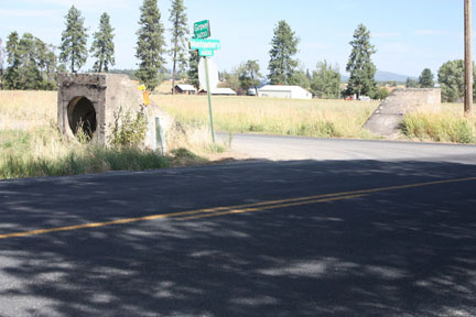
Concrete road underpasses stand at the corner of Grove and Montgomery Roads northwest of Deer Park. 
The ditch leading from Loon Lake to the irrigation valve shown in the upper right picture.
Square concrete underpass flume supports on Antler road east of Cedar Road east-southeast of Deer Park. Note the wooden blocks on the edges of the flume support.
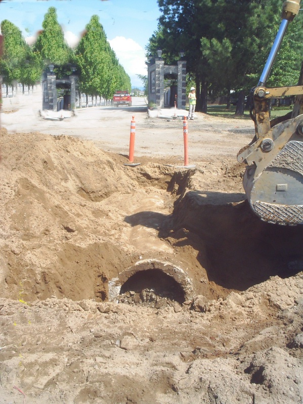
Digging out the remains of a buried concret irrigation pipe at east Crawford and Country Club Drive. (Photograph courtesy of the City of Deer Park and JUB Engineering.) 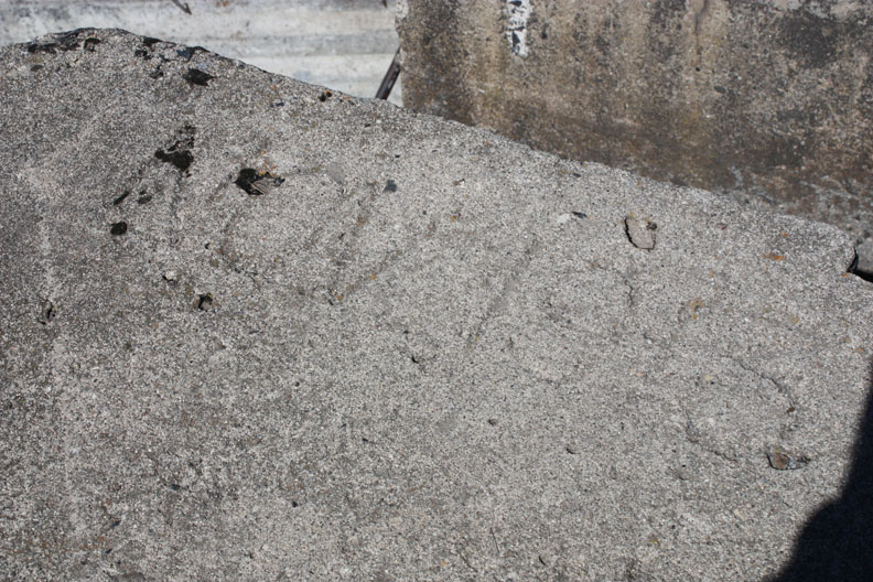
"NOV 1913" scratched into the concrete on top of the Dragoon Creek dam.
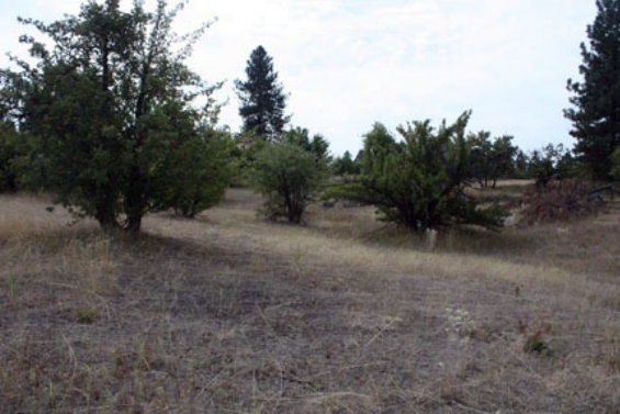
Small Ponderosa pine trees growing between Arcadia Orchard apple trees southwest of the Staley-Dalton Roads intersection.
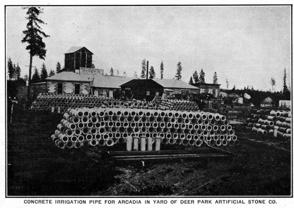
The Concrete pipe casting plant in south Deer Park. Picture taken from the 1916 Arcadia Orchard Company brochure. 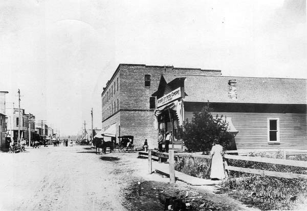
Arcadia Orchards Company office located on south Main Avenue in early Deer Park looking north towards the original hotel building. This building was located approximately where the Odynski accounting offices (the old Louis Olson Builders Supply building) are now. 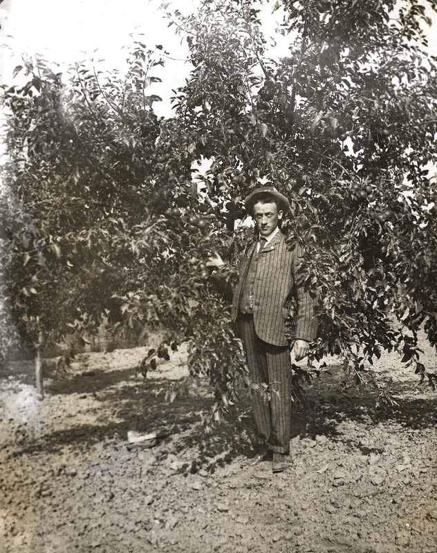
Above is a picture of Mr. Robinson, President of the Arcadia Orchards Company. At this time, Arcadia Orchards Company owned around 16,000 acres in Deer Park and the surrounding areas. Mr. Robinson is standing next to an 8 year old Wagner apple tree that was part of the Wild Rose Orchards Company. We are still researching the affiliation between the Arcadia Orchards Co. and Wild Rose Orchards Co.
Looking west between two concrete flume supports south of the present Deer Park Highschool on a dirt trail that is the extension of Weber Road.
Remains of the Arcadia Orchard highline canal just west of the intersection of Merrit road and Whittier Road just northwest of Clayton, WA.
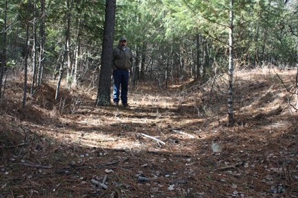
Richard Olson standing in the remains of the Arcadia Highline Canal located in the NW corner of the SW NE Section 17, TWP 29 N-RGE 42 EWM northeast of Clayton in February 2010.
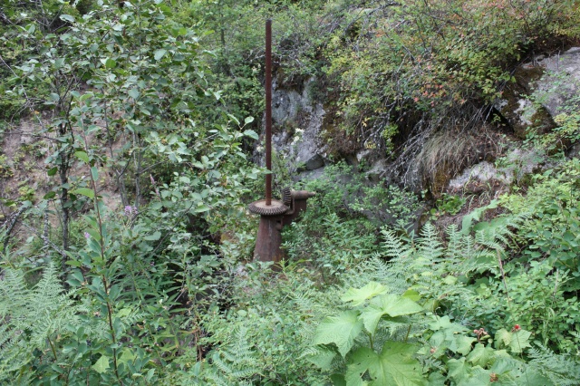
The Shut off Valve at Loon Lake.

Carpenter crew in front of a flume trestle south of Deer Park that supposedly cost over $7000. Photograph courtesy of the Northwest Room of the Spokane Public Library.
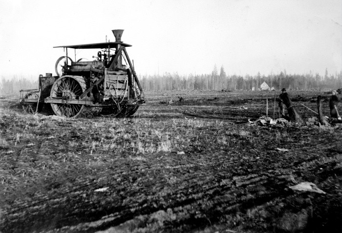
A seventy horse power traction engine pulling stumps to clear orchard lands. Photograph courtesy of the Northwest Room of the Spokane Public Library.
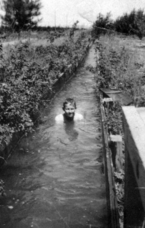
Lawrence Spitzer "swimming" in an Arcadia Orchard flume southeast of Deer Park. Lawrence was an uncle of Carl Justice. The Spitzer family lost their orchard in the collapse of the Arcadia Orchard Holding Company. Photograph courtesy of Carl Justice.
|
The valve works just south of Loon Lake that controlled the flow of water into the Arcadia Orchard irrigation system.
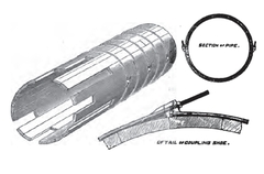
Drawing of wooden-stave pipe construction.
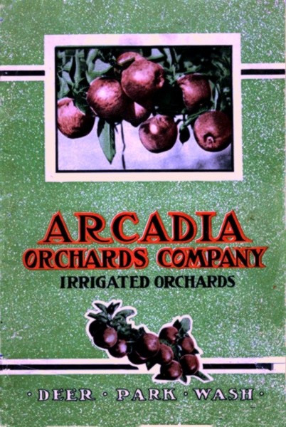
Cover of a 1916 Arcadia Orchards Company flyer.
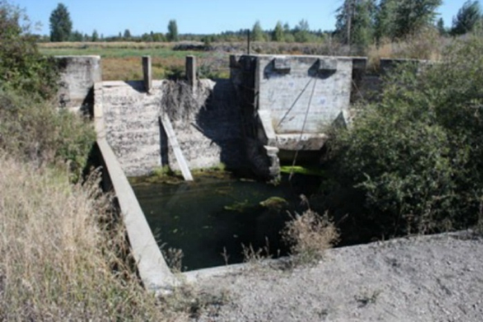
The Dragoon Creek dam in the Summer of 2009 from the road and railroad overpass.
Arcadia Orchard apple trees still producing fruit along Deer Park-Milan Road just west of Cedar Road.
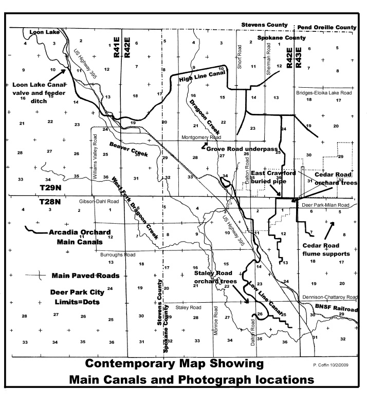
Index map showing photograph locations and main irrigation canals on an comtemporary base.
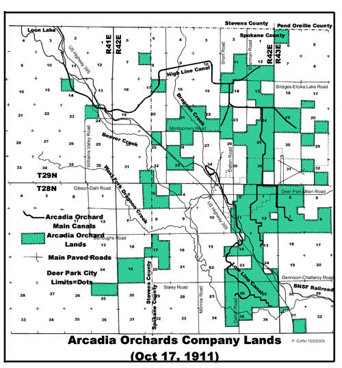
Map showing Arcadia Company land ownership in late 1911. The data for this map was copied from an original company blue print (courtesy of Lawrence Benson of Ramer & Assoc. L.L.C.). Combining this map with a 1912 Ogle Spokane County ownership map shows that nearly 16,000 acres were owned by the Arcadia Orchard Company shortly after 1912.
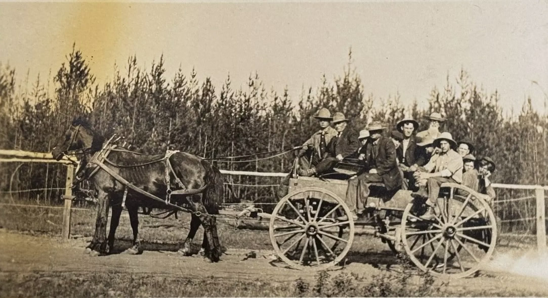
Group of workers headed to "asphalt the flume" for the Arcadia Orchards - 1911

Survey crew in the Arcadia Orchards. The surveyors were very accurate in their work. Note the white shirt and tie dress, they were "professionals". Photograph courtesy of the Northwest Room, Spokane Public Library.
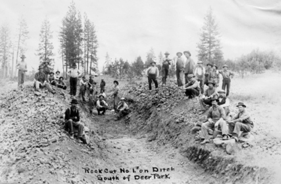
A rock cut into the basalt bed rock south of Deer Park near US 395 and Dalton Road for the Low Line Irrigation channel. Photograph courtesty of the Northwest Room of the Spokane Public Library.
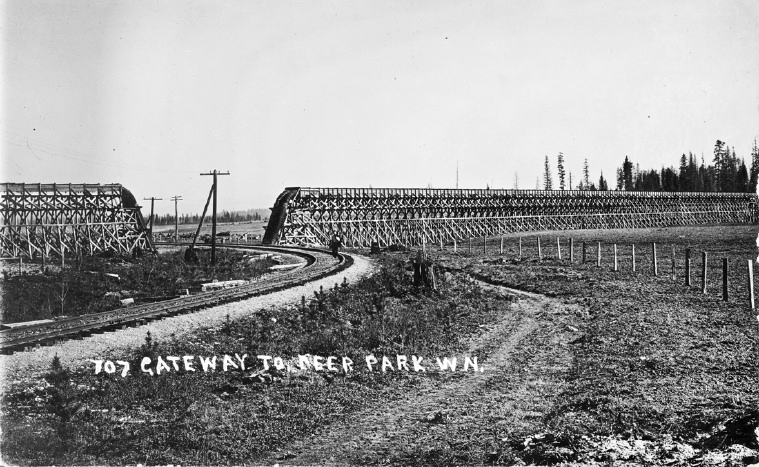
Gateway to Deer Park, WA, compliments of Mike Denuty of Spokane, WA. This is believed to be the view one would have arriving in Deer Park on a daily train from Spokane about 1910 to 1920.
A single concrete flume support south of Staley Road (east of Dalton Road) near Sherman Road.
One-half of a concrete road underpass just east of Dragoon Creek on Montgomery Road northwest of Deer Park, WA.
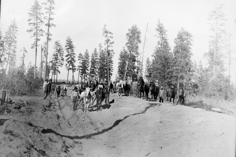
Digging a irrigation ditch with horse teams. Photograph courtesy of the Northwest Room of the Spokane Public Library.
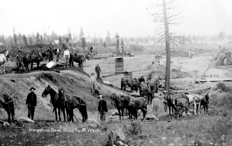
Building the first Dragoon Creek dam northwest of Deer Park. The dam was of dirt filled timber and was replaced by the concrete dam shown in pictures above. Photograph courtesy of the Northwest Room of the Spokane Public Library.
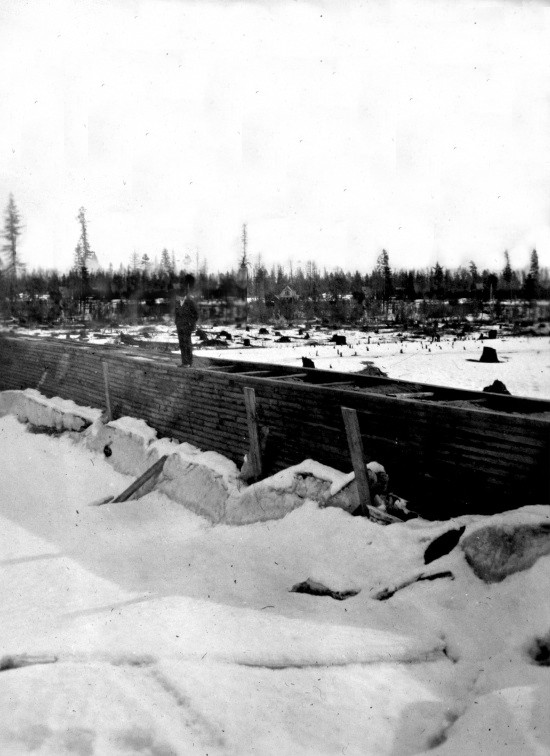
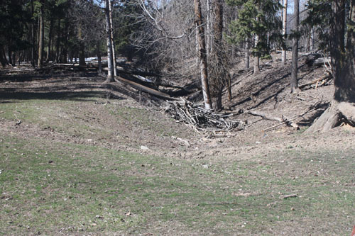
Part of the dirt filled retaining dyke built to keep the Arcadia Dragoon Creek reservoir from spilling into the nearby Spring Creek drainage. Photograph courtesy of the Northwest Room, Spokane Public Library.
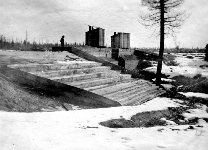
The timbered flood spillway at the Dragoon Creek dam. Photograph courtesy of the Northwest Room of the Spokane Public Library.
|